04 March 2020

Nidd 2: Knaresborough to Nun Monkton

Day 2 of the River Nidd ride featured the world’s first unicycle, Yorkshire trompe l’œuil, my namesake’s cave home, the UK's tallest maypole, and the slightly flooded end of the ride at the mouth into the Ouse. (Back to ← Day 1)

Resuming at Knaresborough railway station, I made my way into the main square.

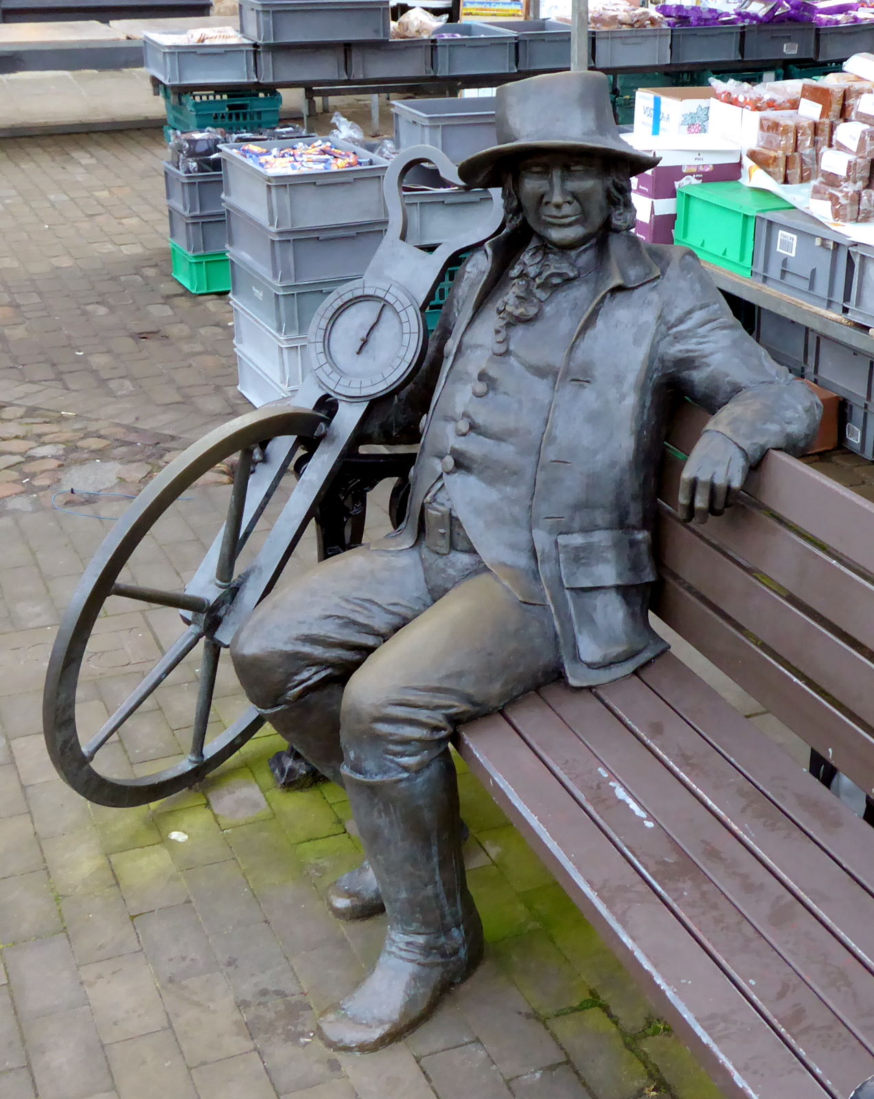
A monument there (pic) celebrates the town’s most famous son, Blind Jack of Knaresborough.

Sight loss notwithstanding, Jack was an expert fiddler and road-builder – that elusive combination of skills – but on the evidence of this apparently also devised the world’s first unicycle, complete with a massive speedometer.


It was market day, and stalls were being set out (pic). Fruit was being arranged, vegetables stacked, and apostrophes prepared for misapplication. That statue is of alleged prophetess of doom Mother Shipton, the town's most famous daughter.


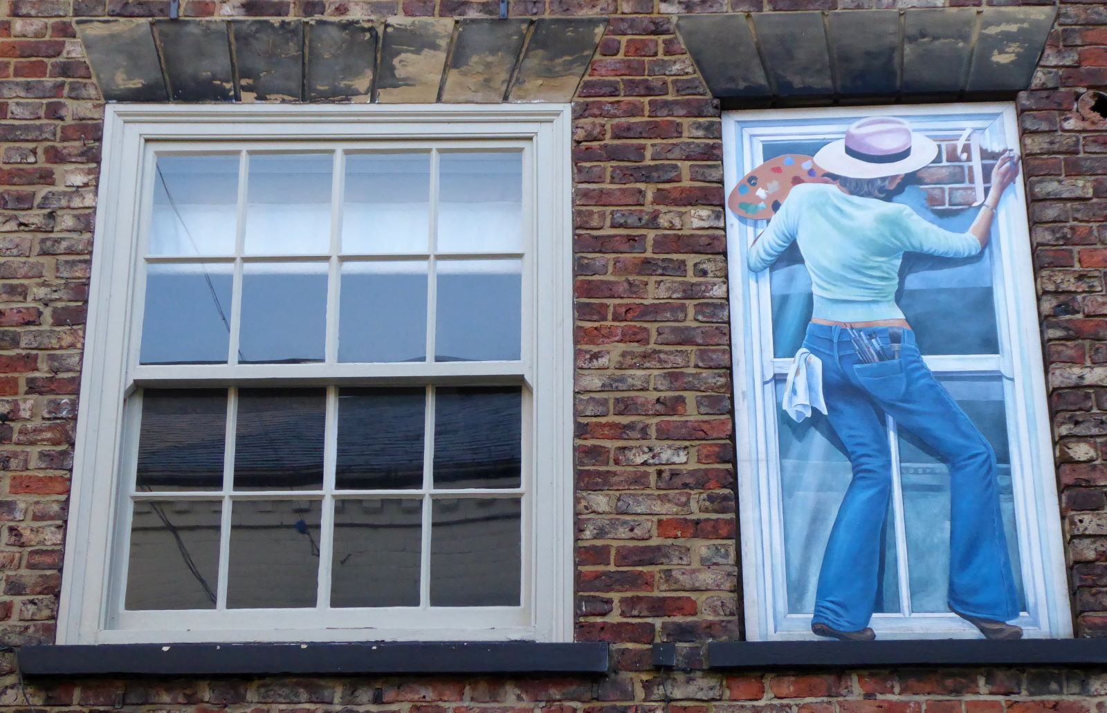
A notable feature of Knaresborough, apart from its chessboard-pattern houses, is its trompe l’œuil windows (pic). And here, meta-trompe-l’œuil, oh, very clever. Housepainting in the 1970s evidently had a different approach to Health & Safety.

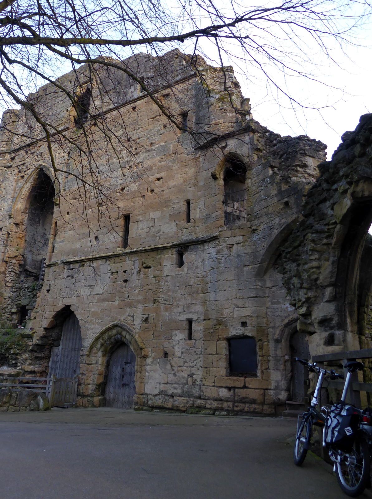
It was still early – just gone seven – and I had the castle to myself (pic). Which meant I had no qualms about cycling around it.

Where was everyone else? Self-isolating, perhaps.


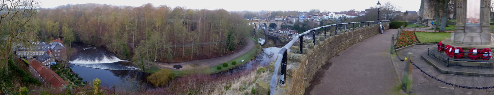
The view from the castle rock is pretty spectacular... (pic)


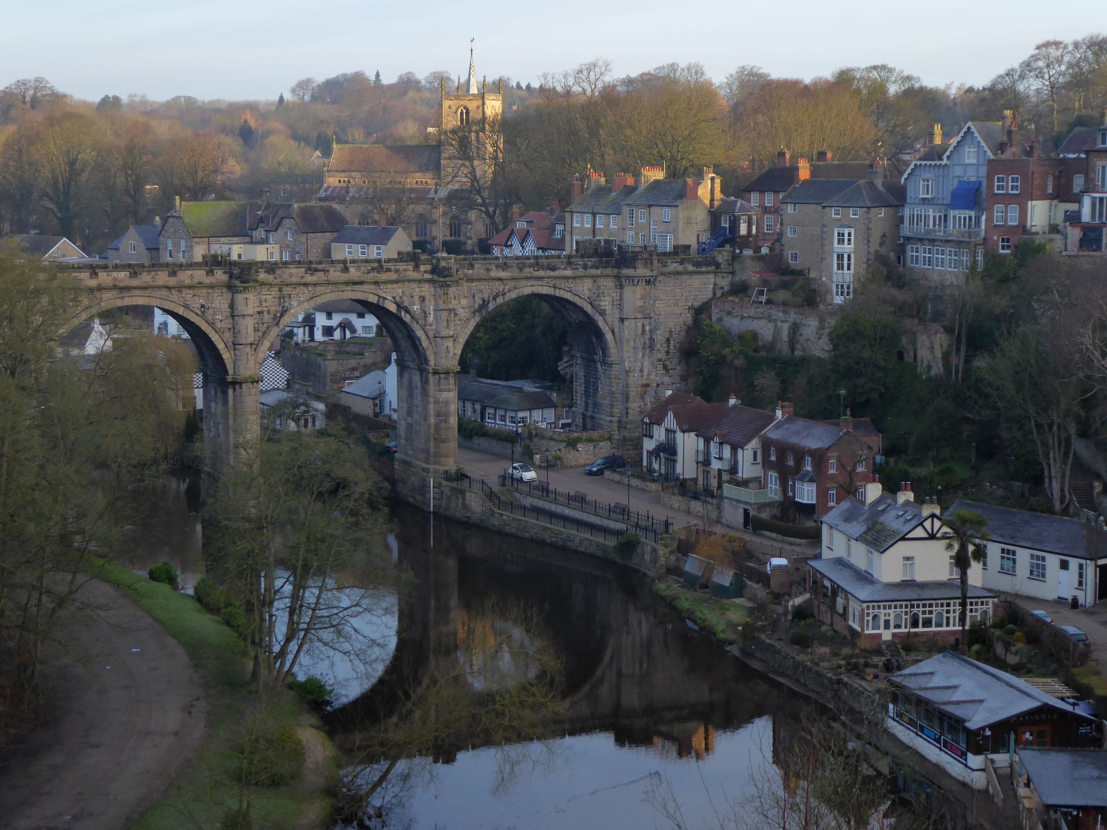
...and shows off the magnificent railway viaduct (pic). It was built in 1848, replacing the previous effort which collapsed that year. Several thousands of fish died, and several dozen lawyers thrived on the ensuing legal action.

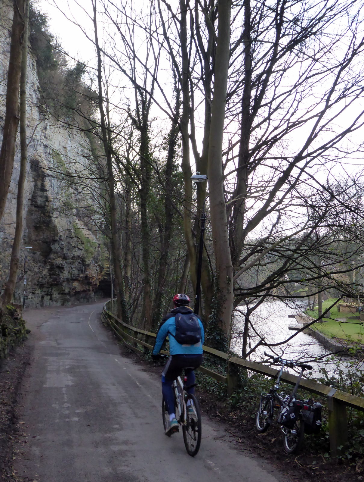
The stretch from here through town east alongside the Nidd is super.

I followed the lane along with other cyclists (pic) around the hulking cliffs which, reassuringly, are protected from rockfalls by wire cages.


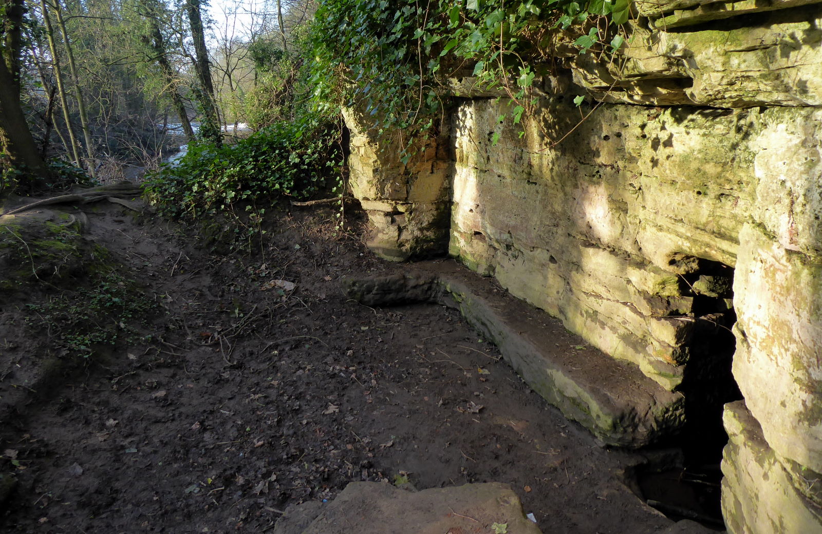
At the north end of town, by the riverside, is St Robert’s Cave (pic), named after the 12th-century hermit and wise man who lived here. He had no children, didn't live in a building, didn't burn fossil fuels, ate only what he could forage and bathed in the cold muddy waters of the river, so was clearly a role model for sustainability.

From here the Nidd, as if confused by the flatpack farmland, starts to meander wildly on its final stretch towards the Ouse.

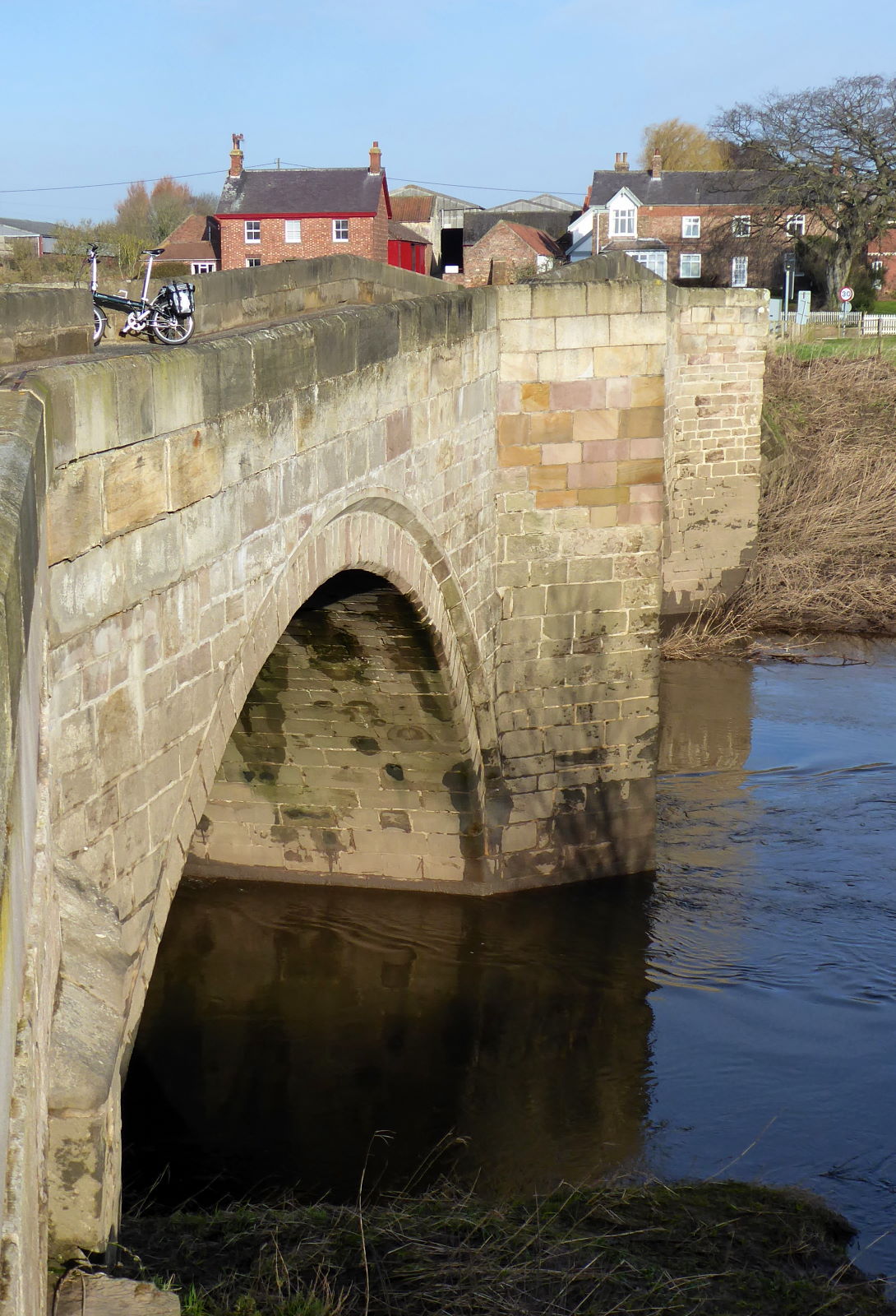
The road, more certain of where it’s going, cracks on in straight lines, so I made good progress in the pleasant morning sun to Cattal’s pleasant but narrow bridge (pic).

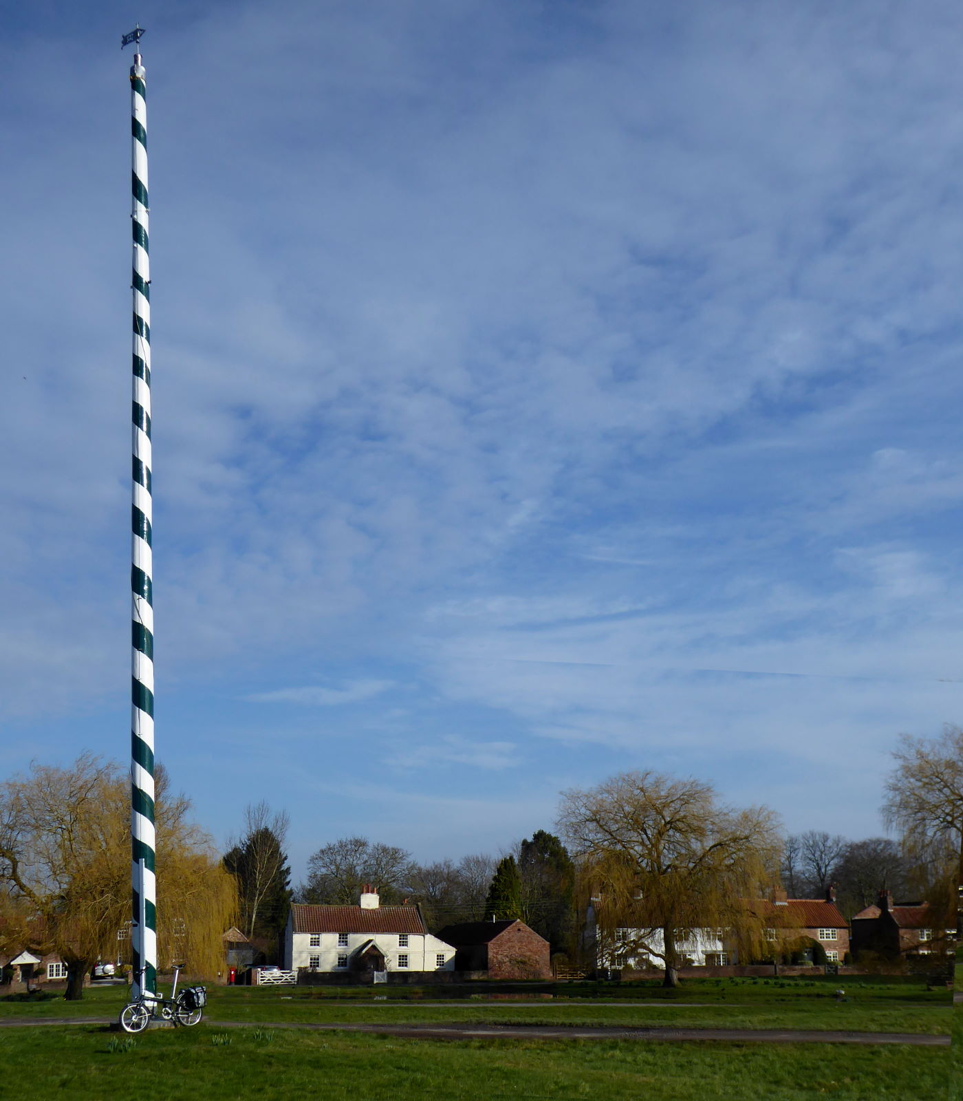
The Nidd is last seen at Nun Monkton, which I’ve blogged about before: proud owner of perhaps Britain’s smallest ferry and certainly tallest maypole (pic).


Here is where the Nidd ends (pic): joining the Ouse from the right, opposite the grounds of Beningborough Hall, a few miles north of York. The waters had subsided after the weeks of flooding, but were still high – that's the ferry landing stage, clearly out of action.


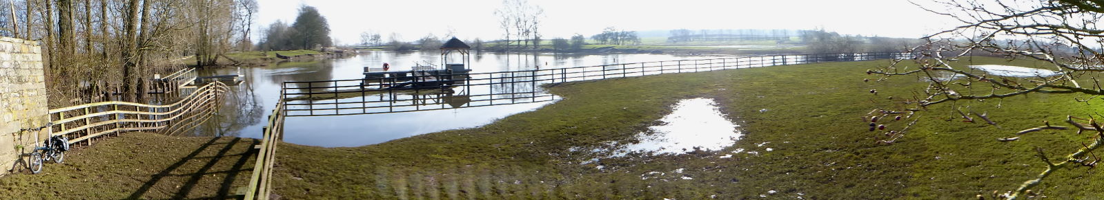
This panorama (pic) was my final view of the Nidd. I zipped back to Hammerton to get a train home, abstemiously by-passing the Alice Hawthorn pub in the village. Mind you, it was still only ten o’clock, so it wasn’t actually open yet.

Miles today: 25
Miles total: 71

Back to ← Day 1

02 March 2020

Nidd 1: Scar House to Knaresborough

River Nidd

Source   Nidd Head, Great Whernside
Mouth   River Ouse, Nun Monkton
Length   59 miles
Towns   Pateley Bridge, Knaresborough
Route   See on Ridewithgps

The sixth of my Rivers Rides was a varied two-day, 80-mile trip from remote moortop to muddy estuary along the River Nidd. Day 1 featured monster chess pieces, alpine views, snow and sun, unusual pork pies, a little bit of Italy, and a taste of the World’s End. (On to Day 2 →)

Getting near the source needed a bus (pic) which meant the maiden trip for my new (third-hand) folding tourer, or possibly touring folder: a Dahon Speed TR.

I was the only passenger on the 24 from Harrogate to Pateley Bridge, and the only user of the back roads from there northwest up along the Nidd to its source.

No identity problems with this river. There may be impostor Derwents, Calders and Ouses, but there’s only one River Nidd.

Less celebrated than the bigger dales, Nidderdale is a real cracker, an underrated gem, a connoisseur’s delight. And great for pork pies.


The nearest you can get to the origin of the Nidd on a bike is the topmost of the three reservoirs in Upper Nidderdale: Anagram (pic).


Oh, sorry, Angram. An anagram of ‘reservoir’ is ‘river rose’, though, which is appropriate. The Nidd rose to fill Angram in the early 1900s when this mighty retaining dam (pic) was built, along with Scar House’s even bigger one slightly further down, and Gouthwaite towards Pateley Bridge.

I was astonished to learn that their waters supply the parched population of Bradford, via a pipe that runs almost all underground for 30 miles, working purely on gravity. I’ll remember that next time I quench a curry there.


It was a glorious cold but sunny morning, and there was fresh snow on the tops (pic). That’s Great Whernside in the distance (not to be confused with the confusingly higher Whernside, of Yorkshire Three Peaks fame). The Nidd coalesces there, on its slopes.

Unfortunately this giant rook was the only one of the chess pieces left from the dam’s original design.


I’d slogged twelve miles uphill into the wind from Pateley Bridge, so now I could enjoy freewheeling the same distance back down the lovely upper dale (pic).

The four miles of smooth tarmac up to the reservoirs from Lofthouse is a private road belonging to Yorkshire Water, but you’re allowed to cycle it. I wasn’t the only one doing so this fine morning, but I was probably the slowest.


At Goyden Pot, a couple of miles down from Anagram River Rose, the river – like a Prime Minister avoiding scrutiny from an expert TV interrogator – does a disappearing act, ducking down into a hole (pic).


The course of the Nidd when in spate continues dry for a few hundred metres. It gathers a few springs and restarts, and just outside Lofthouse it’s rejoined by the Goyden Pot branch, which appears out the side of a hill (pic) like a Prime Minister popping up to make some simplistic, populist, unbudgeted pledge in an impromptu press conference.


Anyway, the road continues alongside the Nidd...


...and alongside Gouthwaite, the last of the reservoir chain (pic).


Back in Pateley Bridge, where my bus had decanted me and bike earlier in the day, I ambled up the High St and stopped to admire the yellow ‘penny-farthing’ on the wall of the Oldest Sweatshop in Britain (pic), dating back to 1661. Oh, sorry, sweetshop.

I also snacked on a fine piece of fusion cuisine – the fusion being Yorkshire–Yorkshire – from Kendall’s the Farm Butcher: a pork pie with mushy peas (pic).

Mindful of floods on the south bank road alongside the Nidd – the bus had waded through them on my way out – I took the higher alternative on the north bank to Summerbridge, and past a place entertainingly called New York. Alas, no amusing signpost photo opportunities: it’s an industrial estate.

The sun was out, the fields were a glistening emerald, and I was happy. Perhaps it was the mushy peas.


I rode over the toll bridge at Hartwith Mill (cars 35p, bikes free) and went through Clint along the Sustrans route to lovely Ripley, with its castle and Italianate village (pic). So Italianate that it’s famous for its ice cream, but it was too cold for ice cream today. I didn’t want raspberry ripple all over my gloves.


Just outside Ripley is this monument (pic) commemorating the Tour de France 2014, which came past here. Not on the Sustrans path, I presume: the cattle grids would outrattle any stretch of Paris-Roubaix.

Then it was the delightful railtrail towards Harrogate, which culminates in the splendid viaduct over the Nidd (pic).

It’s a grand view this way, with the shadow helpfully hinting at the grandeur of the viaduct itself.

The other way is less impressive. It’s a sewage farm.


Journey’s end today was at Knaresborough, its houses stacked up on the gorge side in a rather non-English way (pic).

The town’s most famous daughter is Mother Shipton, the legendary 16th-century seer who predicted the End of the World, according to fanciful 19th-century fabrications, for for 1881. Clearly nonsense. Now, 2020 on the other hand, I could believe.

To celebrate her gloomy soothsayings I dropped into the friendly World’s End pub by the riverside, and enjoyed a pint of Daleside World’s End (pic) to round off the day.

A refreshing light session beer with hints of viral apocalypse, notes of irreversible climate change, and a long aftertaste of nuclear fallout.

Cheers!

Miles today: 46

On to Day 2 →